
How Residential Land Surveys Help Prevent Future Disputes
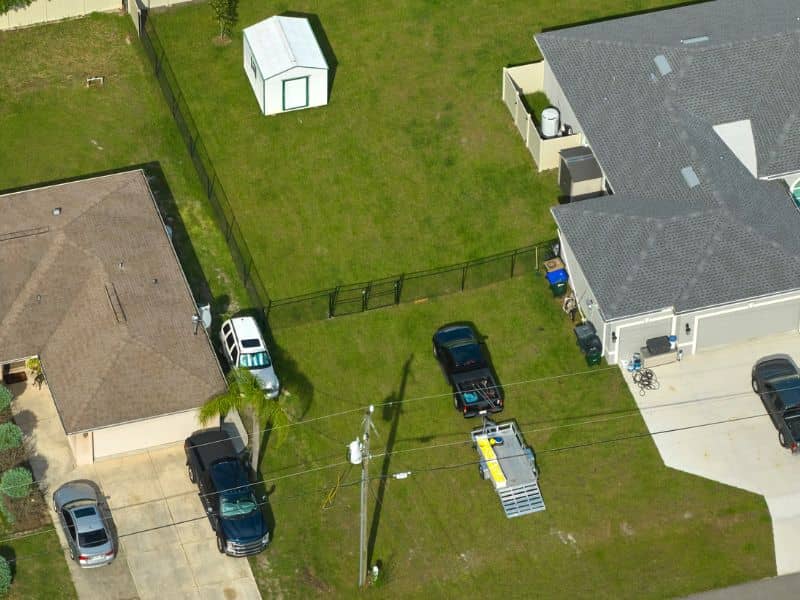
A property line dispute rarely shows up out of nowhere. It usually starts small. A fence that seems a little off. A tree near the edge of the yard. A driveway that might cross onto the neighbor’s land. By the time it becomes a real problem, both sides are often relying on guesswork instead of facts. A residential land survey replaces that guesswork with documented, accurate information before a disagreement ever has the chance to start.
A residential land survey finds the legal boundaries of a property. It also records what exists on the ground in relation to those lines. It gives homeowners a clear, solid record of where their property actually begins and ends.
LaGrange has a mix of long-established neighborhoods and newer growth. Many older lots here have fences, driveways or additions that were placed without a survey to confirm the exact boundary. Getting ahead of that uncertainty is one of the simplest ways homeowners can protect themselves.
Establishing Clear Property Limits Before Questions Arise
The best way to prevent a boundary dispute is to know exactly where your property lines fall before a question ever comes up. A residential land survey gives that clarity through professional measurement and legal research, not guesswork.
Many property owners rely on fences, old deeds or a general sense of where their lot ends. These sources are not always reliable. A fence may have been built in the wrong spot years ago. A deed description can be hard to understand without survey knowledge. A residential land survey removes that uncertainty. It ties the property to its recorded legal description and marks the actual corners on the ground.
Having this information on hand before a dispute starts puts a homeowner in a much stronger position. If a question ever does come up with a neighbor, the survey becomes the reference point everyone can work from.
Documenting Fences, Driveways, Walls, and Existing Improvements
Most property disputes involve something physical, like a fence, a driveway, a retaining wall or a shed sitting close to a boundary line. A residential land survey records these features. It shows exactly how they relate to the legal property lines.
This record matters because it creates a fair, fact-based picture of conditions at a certain point in time. If a fence is found to sit a few feet onto a neighbor’s property, or a driveway appears to cross a boundary, the survey shows this clearly instead of leaving it open to argument.
Common features a residential survey usually records include:
- Existing fence lines and gates
- Driveways and parking areas
- Sheds, decks and other structures near the boundary
- Retaining walls or landscaping features close to the property line
Catching these issues early, before a sale, renovation or new construction project, gives a homeowner time to fix them calmly rather than under pressure.
Comparing Recorded Property Information With Current Site Conditions
Recorded plats and deeds describe a property on paper, but conditions on the ground do not always match those records exactly. A residential land survey compares the legal description to what actually exists on the property today.
This comparison can reveal a few common problems. A fence or structure may not match the recorded boundary. An older lot split may have shifted a line slightly. An old survey used for a past sale may no longer show current conditions if improvements have been added since then.
LaGrange has seen its share of older lots divided or changed over the decades. Some of these changes were not always recorded with the same care used today. A current residential land survey checks recorded information against real, present-day conditions. This is often the only way to catch a problem before it becomes a dispute.
Using Survey Data Before Making Changes Near Property Edges
Many boundary disputes trace back to a project that moved forward without confirming the property line first. A new fence, an addition, a driveway extension or a landscaping project near the edge of a lot all carry risk if the exact boundary is not known.
Using survey data before starting this kind of project gives a homeowner a clear, confirmed starting point to build from. This helps avoid two common outcomes. One is building onto a neighbor’s property without realizing it. The other is building a structure so close to the true line that it creates a setback or permit problem later.
Rules for how close a structure can sit to a property line can be different by city, zoning district and structure type. It is worth confirming those rules along with the boundary itself before any construction begins near a property edge.
Keeping Survey Records for Future Property Decisions
A residential land survey is not just useful at the moment it is done. Keeping a copy on file gives a homeowner a reliable reference for years to come. This could matter for a future renovation, a sale, a refinance or a question that comes up with a neighbor down the road.
Survey records can also help future owners, since a documented boundary survey often gets used again during a property sale or a title review. Keeping the survey with other important property papers, alongside deeds and closing documents, makes it easy to find when it is needed again.
If a lot of time has passed or the property has changed since your last survey, it is worth confirming with a licensed surveyor whether an update or a new survey is needed before relying on older records for a current decision.