↓
 

LaGrange Land Surveying

Your First Choice for Surveying in Lagrange GA

LaGrange Land Surveying
  • Home
  • ALTA Title Survey
    • Atlanta ALTA Land Survey
  • Boundary Surveying
  • Construction Survey
  • Drone LiDAR Mapping
  • Elevation Survey
  • Land Surveying
  • Lot Survey
  • Topographic Survey
  • Contact Us
  • Douglasville, GA (Douglas)
  • Heflin, AL (Cleburne)
  • LaFayette, AL (Chambers)
  • Newnan, GA (Coweta)
  • Ranburne, AL (Cleburne)
  • Wedowee, AL (Randolph)
Home - Page 2 << 1 2

Post navigation

Newer posts →

Land Surveyor: Settling Land Disputes

LaGrange Land Surveying Posted on November 5, 2016 by LaGrange SurveyorApril 1, 2020

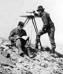
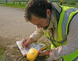
A land surveyor may not be recognized as much as a doctor or a lawyer, but no one can dispute that they play a very crucial role on Earth.

land surveyor

As proof, several countries all over the world have unsettled land disputes over other countries. Some may have been settled through the International Court of Justice, Treaty conditions, or a claimant country’s sovereignty has been recognized. And of course, these were all settled with the help of a land surveyor.

Let’s take a look at some of the famous land disputes all over the world settle by a land surveyor:

  • Mayotte (Africa) – Claimants are France and Comoros. France gained full control under the 2009 referendum, the population supported an overseas department of France, and so became one on March 21, 2011. 
  • Ligitan and Sipadan (Asia) – Claimants are  Malaysia and Indonesia. The 2002 International Court of Justice ruling awarded both islands to Malaysia, but left unsettled the maritime boundary immediately southwest and west of the islands between Malaysia and Indonesia.
  • Eastern coast Narva and Petseri County (Europe) – Claimants are Russia and Estonia. Russia recognized them as a part of Estonia with Treaty of Tartu, 1920. After the fall of the Soviet Union, Russia continued administering it.
  • Tuzla Island and Strait of Kerch; Sarych (Europe) – Claimants are Ukraine and Russia. The conflict arose in 2003 when the Russiam authorities started to build a dam towards the island. Since then Ukraine established a border garrison on the island for a closer surveillance. The reason for the conflict is the fact that Tuzla island strategic location gives Ukraine full rights over the main channel in the Strait of Kerch and, this, the access to the Sea of Azov.
  • San Andres and Providencia (Central America/ Caribbean) – Claimants are Colombia and Nicaragua. Colombia currently has full control because Honduras de facto recognises Colombian claim.
  • Los Monjes Archipelago (South America) –  Claimants are Venezuela and Colombia. Velenzuela gains full control because Colombia no longer claims the islands, only the surrounding water.

A piece of parcel is something that signifies power and resources thus many countries fight over it. If big countries have unsettled disputes over a piece of land, small land disputes also happen between siblings, husband and wife, and neighbors. Though you can’t hire a land surveyor from an International Court to settle your small land disputes, you can always hire a local land surveyor who can survey your property and resolve any encroachment claims and/or equally divide a property as mandated by law.

A land surveyor plays a very vital role in settling land disputes, big or small. If you are in a situation that you may need the expertise of a land surveyor, please contact LaGrange Land Surveying at (706) 407-2722 today or go to our Contact page and send us an email.

Posted in land surveyor | Tagged LaGrange land disputes, LaGrange land surveying, LaGrange land surveyor, land disputes, land disputes all over the world, land disputes LaGrange, land surveying Lagrange, land surveyor lagrange

Welcome to LaGrange Land Surveying

LaGrange Land Surveying Posted on September 30, 2016 by LaGrange SurveyorSeptember 4, 2020
Newnan land surveying

Welcome to LaGrange Land Surveying’s website

This site is intended to provide you with information on a Land Surveying Company in LaGrange, GA. If you’re looking for a LaGrange Land Surveyor, you’ve come to the right site. If you’d rather talk to someone about your land surveying needs, please call (706) 407-2722 today. For more information, please continue to read. 

Newnan land surveying

Land Surveyors are professionals who measure and make precise measurements to determine the size and boundaries of a piece of real estate.  While this is a simplistic definition, boundary surveying is one of the most common types of surveying related to home and land owners. If you fall into the following categories, please click on the appropriate link for more information on that subject:

LaGrange Land Surveying services:

  1. I need to know where my property corners or property lines are. (Boundary Survey)
  2. I have a loan closing or re-finance coming up on my home in a subdivision or I’m purchasing a lot or house in a recorded subdivision. (Lot Survey)
  3. I need a map of my property with contour lines to show elevation differences for my architect or engineer. (Topo Survey)
  4. I’ve just been told I’m in a flood zone or I ‘ve been told I need an elevation certificate in order to obtain flood insurance or prove I don’t need it. (Flood Survey)
  5. I’m purchasing a larger tract of land, acreage, that hasn’t been subdivided in the past. (Boundary Survey)

If your needs don’t fall into one of the above, don’t worry, we’ll get to the bottom of it. CALL LaGrange  Land Surveying TODAY at (706) 407-2722 OR better yet, fill out a Contact Form request to discuss your survey needs.

Posted in land surveying, land surveyor | Tagged LaGrange land surveying, LaGrange land surveyor, Land Surveying, land surveyor, land surveyor lagrange, property line survey

The Essence of Land Surveying

LaGrange Land Surveying Posted on August 5, 2016 by LaGrange SurveyorApril 1, 2020
land surveying

According to research, land surveying has existed ever since the beginning of recorded history. They believe that it has long been used in making the great pyramids; in which historians believe to be very accurate in the calculation of its land area. It was also used in ancient Egypt in re-establishing lost land boundary markers whenever Nile River overflowed its banks. Finally, historians believe that prominent people back then created this practice in order to have refined sharing of the lands they own.

land surveying

Also, there are verses in the Bible that support the practice of land surveying

  •  Proverbs 22:28 Do not move the ancient boundary, which your fathers have set. 
  •  Deuteronomy 19:14 “You shall not move your neighbor’s boundary mark, which the ancestors have set, in your inheritance which you will inherit in the land that the Lord your God gives you to possess.
  • Deuteronomy 27:17 ‘Cursed is he who moves his neighbor’s boundary mark.’ And all the people shall say, ‘Amen.’ 

Now what does land surveying really mean?

Land surveying basically means measuring and mapping lands. It is the science of accurately calculating the land’s area; determining the points of distance between a land and another. The actual purpose of this is to establish land maps and set boundaries for ownership. It is commonly used in the execution of nearly every form of construction.  The system of land surveying has proved itself to be a very important factor in the development of human environment as the earth’s surface continues to change according to the lifestyle of people.

land surveying

Just imagine a world where people freely claim an area of land for their benefit without even thinking of the others. Imagine people crossing over another person’s land because there are no borders that would express the ownership of anyone. Imagine people building any construction they want in any land they prefer. Or just simply imagine your neighbors removing your fences. If this happens, it would lead to chaos. That is why land surveying has been made to follow.

The importance of land surveying is identical to its purpose. It is responsible in the establishment of the maps of every city, region, country, continent or the earth itself. Through this system, there would be definite borders blocking any people from owning what another person owns. With this procedure, the distribution of the vast space of land would be fair enough. Everything would be organized and regulated.  This would mean that the buildings, railroads and even our houses would be made without having any complications if it had undergone land surveying.

As you can see in books, magazines, websites and other things that contain information about our world’s structure, we can see that there are boundaries which separate one place from another. This diminishes the complications in the ownership of lands among people. Since humans tend to get selfish, it is best to have everything in order, up to the issue of allocating land areas for everyone. This is the real essence of land surveying.

Call LaGrange Land Surveying today at (706) 407-2722  or fill out a contact form request for more information concerning your land surveying needs.

Posted in land surveying, topo surveying | Tagged LaGrange land surveying, LaGrange land surveyor, Land Surveying, land surveying Lagrange, land surveyor, land surveyor lagrange

Things to Know When Building Your House

LaGrange Land Surveying Posted on July 5, 2016 by LaGrange SurveyorApril 1, 2020
land surveying

Land Surveying in Building your house

land surveying

It is a very good idea to build your home because you will be able to get exactly what you want instead of when you buy. Of course, you may need to add some things or you may not know what you are getting yourself into.

It is a huge decision choosing the right builder since it is one of the largest personal investments that you will make. Be sure to give an interview to all of the possible contractors and then pick the one that will help make your dream home come true. While you are talking to the possible contractors be sure you ask all of the pertinent questions that will help you choose the best; their how long they have been in the business, experience,  what are the kind of buildings that they have experience building and it would be great if you can see some of their work. It is also crucial to pick house plans which may lead to a good home now and in the future. This is something that your contractor should be able to help you with and they may call on the services of an architect.

Budget in building your house

Before to planning your house design consider these factors; your budget, the size of the home to be built, location of the home, wall finishes, design features that you would like, ceiling height, number of stories, fixture types, exterior finishings, also your time frame. 

If you happen to be uncertain about any of these items, your contractor or architect should be able to guide you through this very important process. They will help you choose the details that are right for you down to the very smallest detail. They may refer you to other consultants for things like finishes, colors, and the like so be prepared to sit and discuss with them for a few hours to talk about all these choices that you may have.This is the reason that your choice of a builder is important. 

If your builder isn’t able to advise you on home location they should refer you to a real estate agent. A real estate agent is familiar with important details like neighborhood home values, school districts, traffic issues, funding options, etc.

Land Surveying: avoids future problems

Another stop you should make is to see a land surveyor. Land surveyors are trained and experienced in identifying features of the land that might have an impact on your new home – called land surveying. Some of these features are flood zones, property line encroachments from neighbors, lot dimensions, and building setbacks. Land surveyors are measurement experts. And, since your home is your most valuable asset, land surveying should be one of your first steps in any new construction.

Avail Land Surveying service from your local surveyor:

Call LaGrange Land Surveying today at  (706) 407-2722   or fill out a contact form request for more information concerning your land surveying needs.

Posted in land surveying, topo surveying | Tagged LaGrange land surveying, LaGrange land surveyor, Land Surveying, land surveying Lagrange, land surveyor, land surveyor lagrange

Estimate The Costs Of Flood Damage To Your Home

LaGrange Land Surveying Posted on June 12, 2016 by LaGrange SurveyorApril 1, 2020

Why you need a flood survey before building a home?

The tool below allows you to calculate the costs of flooding. Select a home size that approximates yours and then slide the blue button up or down for the expected depth of flooding.

What can a flood survey do for you?

A flood survey can be done by your local land surveyor. This will help you in making important decisions such as buying a property and building your home. Through a flood survey, you get to save thousands of dollars worth of property. Also, you get to protect your family and achieve that peace of mind that everything you’ve worked hard for is safe. 

flood survey

Call Lagrange Land Surveying TODAY for a free flood risk assessment of your home. We will review the flood maps in your area and advise whether we recommend a flood survey. CALL US TODAY at  (706) 407-2722 or fill out a contact form request. Our flood survey report will give You Peace of Mind.

Posted in flood survey, land surveyor | Tagged elevation certificate, elevation survey, flood determination, flood survey, Land Surveying, land surveying Lagrange ga, land surveyor

Post navigation

Newer posts →
© LaGrange Land Surveying
LaGrange, GA
Phone: (706) 407-2722

Web Development and SEO by:
N2Biz.co


Privacy Policy | Terms of Use

↑